
Tools of the trade
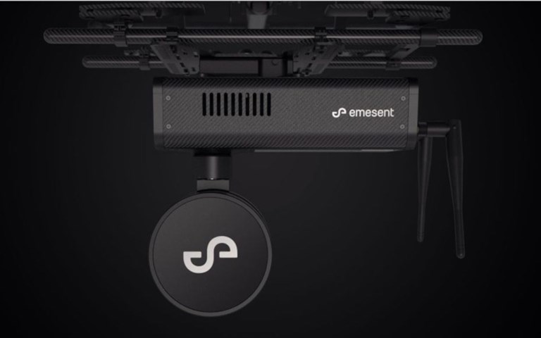
Smart scanning Emesent’s Hovermap uses light detection and ranging data for streamlined mobile scanning
Emesent’s Hovermap uses light detection and ranging data for streamlined mobile scanning
February 13, 2020
More Tools of the trade
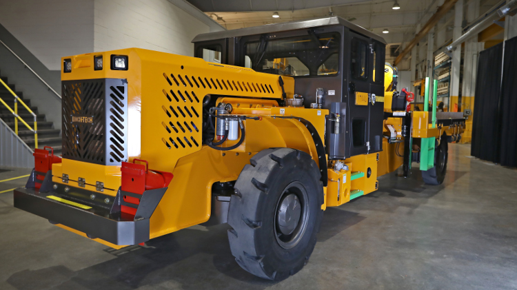
Simplified controls
Rock-Tech's Gen II Titanium underground utility vehicles designed to reduce in-cab distractions
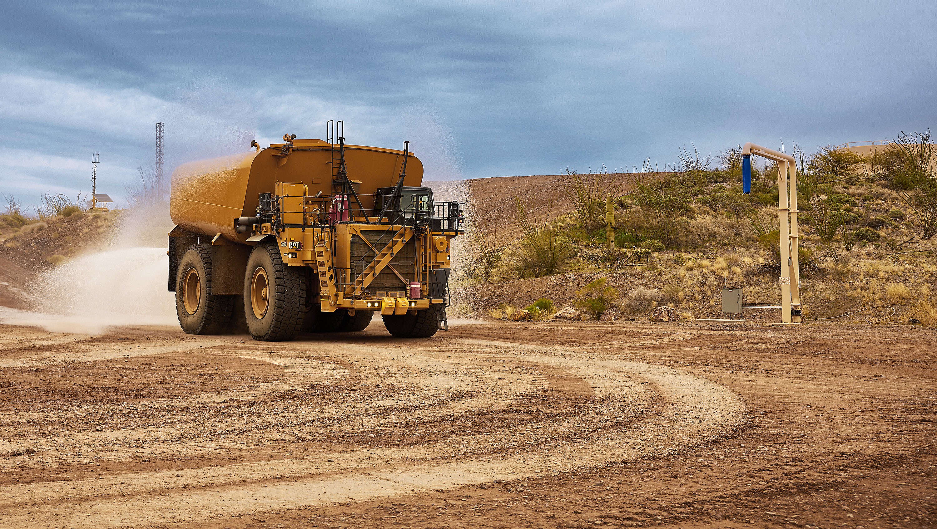
Autonomous watering
Caterpillar’s largest water truck delivers adaptive water control for effective dust management