Andy Low is a senior wildland fire specialist and registered professional forester at Forsite Fire, a division of Forsite Consultants. With over 25 years of experience in wildfire management, Low began his career as a wildland firefighter, working across some of Canada’s most fire-prone regions. His experience includes rappel firefighting (rappelling from a helicopter into otherwise inaccessible remote areas to fight wildfires) with Parks Canada and the BC Wildfire Service Rapattack program, followed by several years in the active Penticton Fire Zone in the Okanagan region.
Low went on to hold a position as provincial wildfire preparedness officer in the Provincial Wildfire Coordination Centre in Kamloops, before joining wildland fire management specialist John Davies at Davies Wildfire Inc. in 2017. Davies and Low went on to launch a new wildfire consulting firm, Frontline Operations Group, in 2019. In 2023, they sold the company to Forsite Consultants, and they now lead the Forsite Fire team, focusing on wildfire risks, impacts and mitigation strategies tailored to communities, governments and industry clients, including mining operators.
In a conversation with CIM Magazine, Low shared insights on how wildfire risk is evolving, what mining operations need to understand about mitigation and resiliency, and the role emerging technologies play in improving emergency planning and preparedness.
CIM: What key risks and impacts can wildfires have on a mining operation?
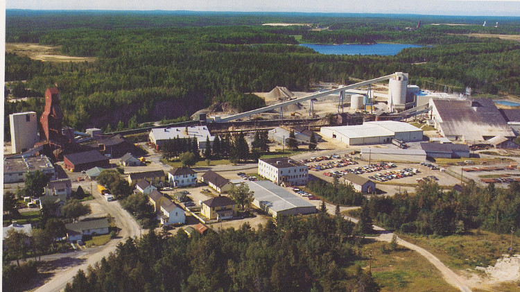
Low: When it comes to wildfire risk, we have to distinguish what stage a mine is at and what its footprint looks like. For example, an established, operating mine is generally resilient to direct wildfire impacts because there are usually large, cleared areas around the site, and the material around is typically non-flammable, such as rock, gravel and defensible space. Defensible space is the area between a structure and adjacent wildland fuels [combustible materials that can sustain a fire, such as vegetation or other organic matter]; adequate defensible space can slow or halt the progression of a wildfire, [and] it can also provide wildland firefighters room to operate around structures during firefighting and structure protection operations. The buildings themselves are also usually built with non-combustible materials like metal or concrete.
The concern is all the other things that might be on that mine footprint: vehicles, materials [or] debris that may be accumulated or not yet disposed of. During a high-intensity wildfire, you are going to see not just radiant heat, but embers being cast far ahead of an active crown fire. With adequate defensible space, it is often not the big flames that burn down buildings, but the embers that are igniting parts of a building, materials or nearby combustibles, which can then spread to the entire structure and potentially from building to building.
The other, bigger concern we have is the impact the fire might have on the different critical infrastructure of the mine, whether that be roads for transportation or electrical transmission and distribution lines that traverse long distances through forested areas. It is not just the fire threat to the mine site itself, but also to all those different connections that the mine operation relies on.
No matter the size or scale of an operation—whether at the mineral exploration stage or full production—we need to remember that we are operating in, and are subject to, the wildfire environment. Operators need to be able to understand and plan for wildfire risks to their people and assets.
CIM: What does an effective wildfire risk mitigation strategy look like for mining operations?
Low: We like to frame this as a journey towards wildfire resiliency and that starts with quantifying or characterizing the risk. When we conduct a risk assessment, we are looking at the different factors of the wildfire environment within which the mine and its connections are situated, including fuel, vegetation and forest types.
We also look at topography: is the mine on flat ground? Is it at the top of a hill? Is it at the bottom? What about the power lines or roads—are they on high ground, or are they in the valley bottom?
Then we examine prevailing and historic weather conditions and analyze them using the Canadian Forest Fire Danger Rating System. We track fuel moisture codes [numeric ratings of the moisture content of the forest floor and other dead organic matter] and fire behaviour indices over time and look for increasing trends, as these are good indicators of rising risk.
Having boots on the ground is a key part of a complete wildfire risk assessment and mitigation plan. A desktop review only goes so far; there is huge value in having us or a wildfire professional consultant visit the mine site to gain a deeper understanding of the key assets and processes. When someone can walk the site and assess the fuel structure and how the built environment relates to the forested environment, they can begin to put together what the risks could look like if the mine were threatened by wildfire.
So, we combine desktop analysis with on-site assessment. Integrating those factors with the site’s activity gives us a strong sense of the overall risk to the site and the operation.
From there, it is about finding out the ways these risks can be mitigated. In some cases, those mitigations might be very simple. They may include just tidying up a site, removing dilapidated wooden buildings that are highly susceptible to ember ignition. It may involve moving flammable materials away from permanent structures. Or it could be reviewing the entire road network that connects everything to the mine, or the power that is delivered to the mine. We also consider strategies such as establishing or increasing defensible space through vegetation clearing as well as opportunities to incorporate protective solutions such as pole wraps on wooden power poles. These are all examples of potential physical mitigations.
To tie it all together, we help our clients figure out how best to incorporate wildfire risks into their emergency response plans. Do they track fire danger? Do they have an awareness of what potential fire behaviour they could face that day, tomorrow or in a week? That way, the operation has the best information to support daily planning and, if needed, begin executing an emergency response and make informed decisions about the safety of personnel and the protection of assets on site.
CIM: Could you share a real-world example of Forsite Fire putting a mitigation strategy into action, and what value it brought to the client overall?
Low: A good example of the value of having that on-site look with our own eyes and speaking directly with the people responsible for key operations is a project we did in Yukon in 2024. This was for a mine under care and maintenance, transitioning into remediation. The site had water quality issues and a network of end-of-line systems, which caps, diverts and captures contaminated water and then pumps it into a water treatment facility or back into a holding pond.
The site itself is massive, with most buildings located in a vast landscape of broken rock and roads. However, the critical end-of-line capture and pumping systems were situated right at the edge of the mine and adjacent to the forest. Through the assessment process, we were able to focus on the most important function of the care and maintenance program: preventing contaminated water from entering the environment.
If fire were to impact those really important sites, that could result in contaminated water entering the environment and causing all sorts of problems. I do not know if that kind of insight and the level of importance those sites represented would have been adequately conveyed solely through a desktop analysis. It really came about through physically going to the site, meeting with the engineers and touring the site with them.
CIM: Are there any emerging technologies that are making a significant impact on the future of wildfire risk mitigation?
Low: We make use of fire behaviour and fire growth modelling at a high level, so we are able to model thousands of iterations of fire growth scenarios.
We had another example in B.C., where a mine was connected to a highway by a 60-kilometre road through mountainous terrain. The mine site itself was well protected from wildfire threats due to its location among glaciers, rock peaks and avalanche chutes, but the biggest wildfire risk factor was the road that people, supplies and the full supply chain would [use to] travel in and out of [the site].
Our focus narrowed in on that road, and we conducted fire behaviour modelling informed by our on-site fuel type assessments, which can be especially important in areas where there is no great fuel type match [where the local vegetation is not well represented by the fuel type categories in Canada’s Fire Behaviour Prediction System]. Then we ran some modelling to determine what the potential wildfire impacts on the road could be.
From there, we worked backwards to help the client understand: if a fire starts under certain conditions and within a specific proximity to the road, how much time would they have before they could no longer access the road, or when the fire would impact it.
Being able to give the client a timeframe is important because with a deeper understanding, they can adjust or inform their emergency response planning.
We also have technology able to incorporate light detection and ranging (LiDAR) data into a program that we call Fuel ID. Fuel, weather and topography are the three main inputs into fire behaviour analysis; there is a fuel type [map] for the entire country, and each province has done its own fuel type mapping.
Forsite developed Fuel ID as a process that takes LiDAR data and pulls out tree and vegetation characteristics, and allows us to classify fuels and develop fuel mapping layers at a much higher resolution than the publicly available government maps of fuel types in Canada. This is significant because if you have a better fuel map layer that is more reflective of what is actually there on the ground, you are going to get better model outputs. Fuel ID is available for areas in Alberta, British Columbia and Saskatchewan, and we are currently working on expanding its coverage across Canada.
The other technological solutions that we offer are custom modelling solutions that we have developed for utility clients to help in their day-to-day grid operations. In some cases, those can be easily adapted to a mining context. At the root of it are points, polygons and lines out on the landscape, which can provide clients with an understanding of what the fire impacts could be to them.